About Walton-on-Thames
Location
Walton-on-Thames is in the county of Surrey, some 18 miles by road south west of central London.
Public Services
Elmbridge Borough Council and Surrey County Council provide public services to residents and businesses in Walton-on-Thames. Emergency services for the area are Surrey Police, Surrey Fire and Rescue Service and South East Coast Ambulance Service. The River Thames passes on the northern edge of Walton and is managed by the Environment Agency
Town Hall:. Elmbridge Borough Council Civic Centre, Esher
Library: Walton Library is in the Heart Centre, Walton.
Council Amenity Tip: Shepperton
Recycling rules: What goes in my bin?
Parliamentary Constituency
Walton is in the Esher and Walton constituency. The elected member of Parliament is Dominic Raab MP. The last election was in 2019.
Local Political Boundaries
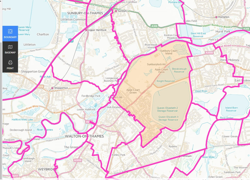
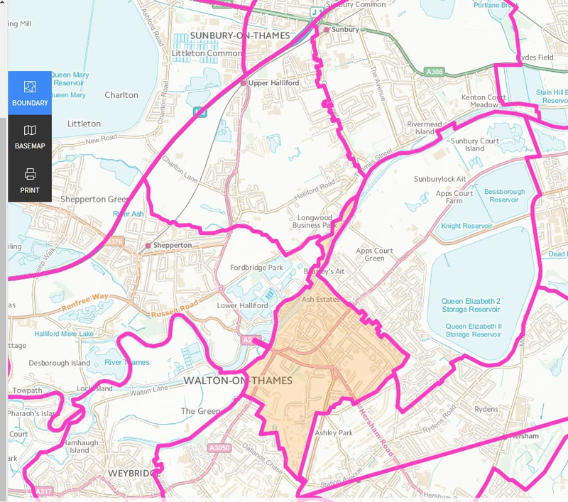
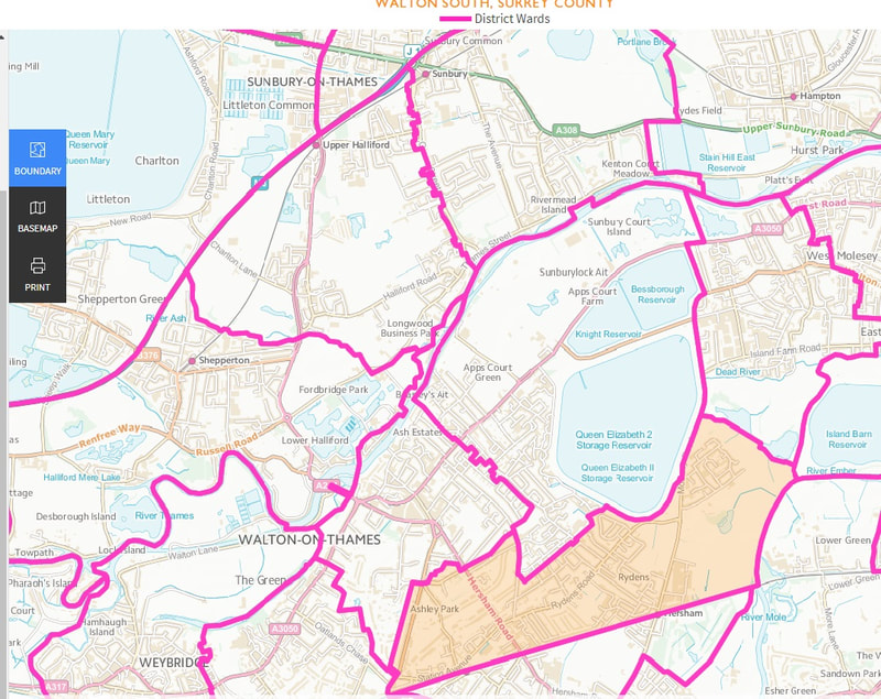
Walton-on-Thames is divided into three wards: Walton North, Walton Central, Walton South
Maps are from Ordnance Survey.
There are three Borough Councillors for each ward.
Walton is represented on Surrey County Council by two councillors
Population
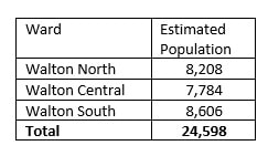
Population estimates are taken from a report 'Knowing Our Communities' published by Elmbridge Borough Council in 2017, page 13.
There are three Borough Councillors for each ward.
Walton is represented on Surrey County Council by two councillors
Population
Population estimates are taken from a report 'Knowing Our Communities' published by Elmbridge Borough Council in 2017, page 13.
Download the full document below
| ebc_knowing_our_communities_2017_v6__final___4_.pdf |
Useful Information About Your Property
'My Neighbourhood', a feature of the Elmbridge Borough Council website, pulls together a wealth of information relating to any property in the Borough. Try it here..
Public Transport
Railway: Walton-on-Thames Station is on the mainline from London Waterloo to the South Coast operated by SWR.
Bus: Halllmark and Falcon Buses operated services to Heathrow Airport, Staines Kingston and Addlestone
Taxi and Uber: Numerous taxi companies and Uber operate in Walton
Highways
Walton-on-Thames is about 10-15 minutes drive from junctions 10 and 11 of the M25 and junction 1 of the M3. Major Roads passing through to town are A244 (running north/south across Walton Bridge and A3050 (running east/west).
Town Centre
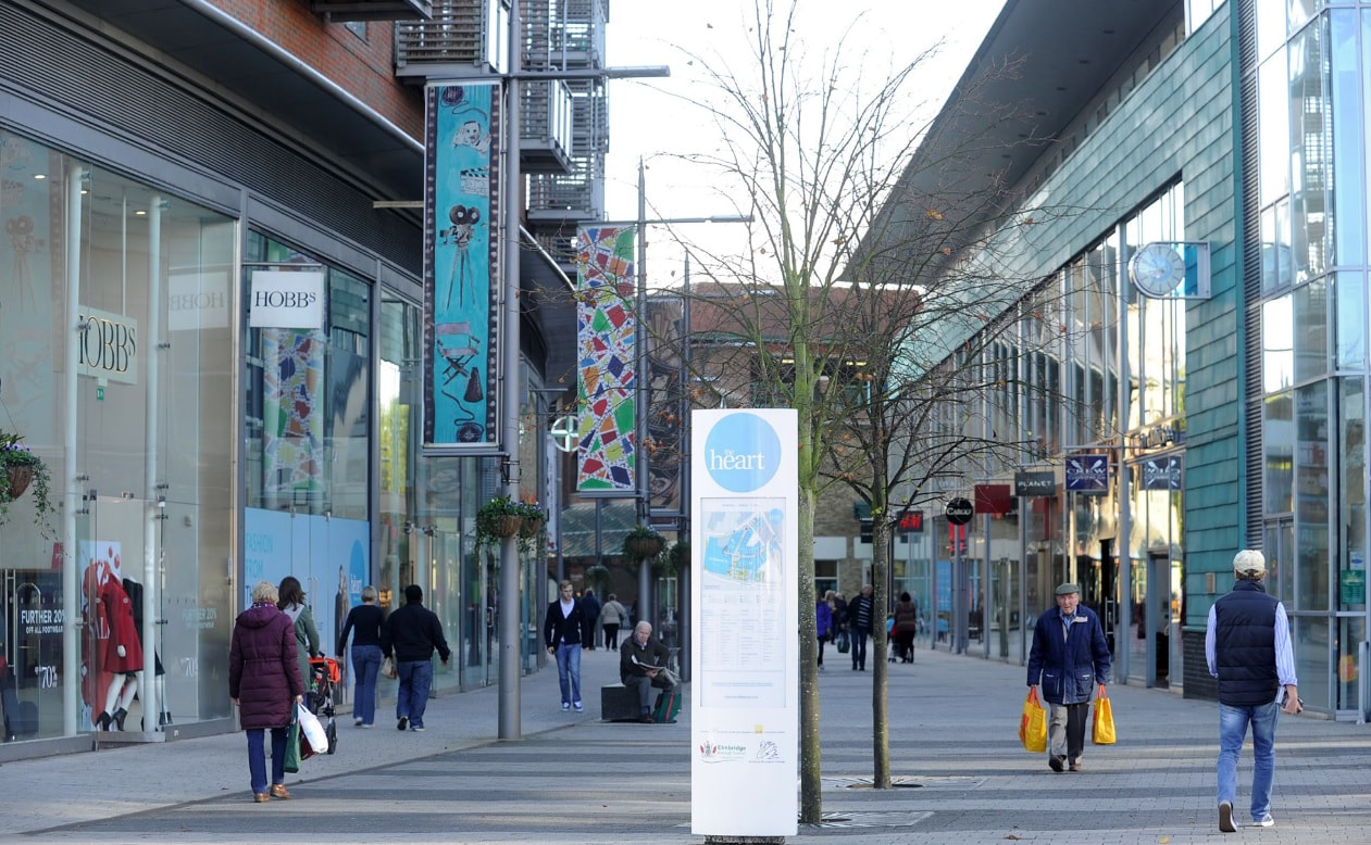
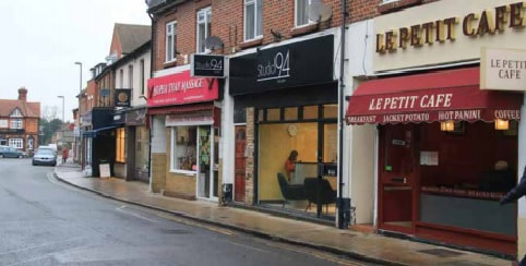
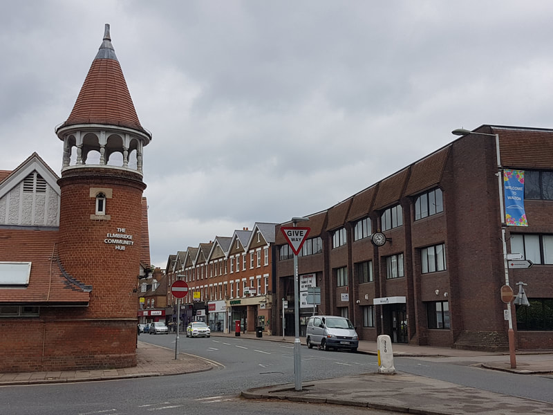
The focus of retail outlets and eateries is The Heart Centre with a range of businesses in Hepworth Way, High Street, New Zealand Avenue, Bridge Street, Church Street and Terrace Road, A second parade is at Halfway in Hersham Road. Walton-on-Thames Trading Alliance works with businesses and volunteer residents to make Walton-on-Thames 'a better place to live and work'. Parking is available in the Heart and several public car parks. Our parking map is here
River Thames
The River Thames marks the northern boundary of Walton-on-Thames. Walton Bridge, the sixth to be constructed since 17.50, carries the A244 across the river. Walton is about 120 miles from the source and 80 miles from the mouth of the river.. The town is on the non-tidal part of the river.
History
The town's history .features Julius Caesar, six bridges, a film studio, the residence of an American President and a church dating back to the 8th century. The Walton Trail, developed by WoTTA, links many historic sites. Walton also has a Postbox Trail.
Developing Walton-on-Thames
Walton-on-Thames Trading Alliance (WoTTA) was set up in 2016 to make Walton-on-Thames a better place to live and work. Volunteers work alongside traders to organise a number of major events including Heritage Day and the Festival of Light. Both events bring large numbers of visitors to the town. In 2019, WoTTA working with Elmbridge Borough Council invited traders to consider whether to establish a Business Improvement District (Walton BID). In 2020, they voted in favour of the initiative.
